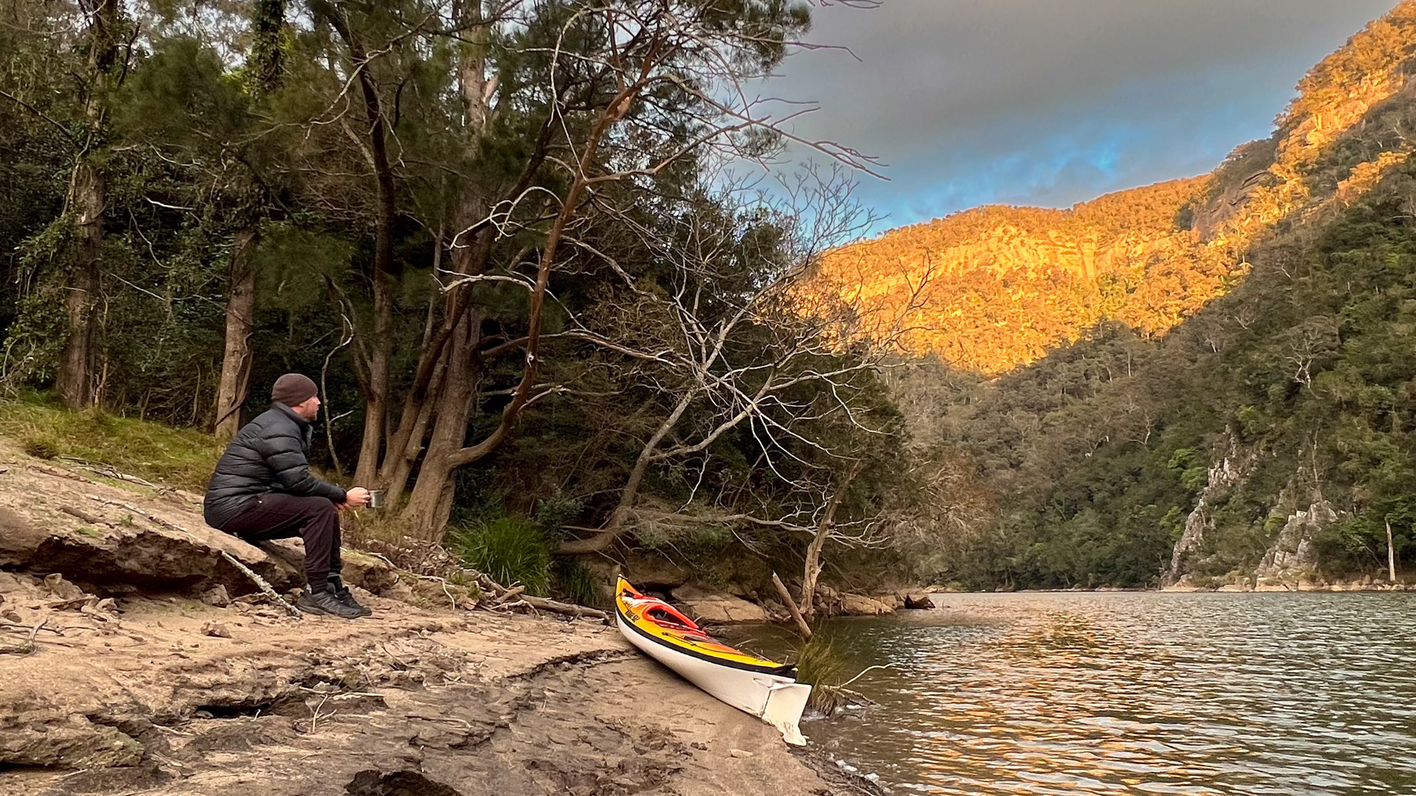
I just spent a lovely couple of days on the Shoalhaven River in the Morton National Park. The photos might make it look peaceful, but I did discover that this incredible valley and the cliffs act like a wind tunnel when you have strong westerly winds. Despite the howling winds and a couple of possums that kept coming into the vestibule of my tent, I managed to have a good night (thanks to earplugs).
The video below is a combination of one of my usual trip videos, but also includes information about all the gear I carry on multi-day paddles.
MY PACK LIST
For a copy of my full packing list that I used for the Summit To Sea Murray paddle, visit this link…
https://summittosea.live/the-gear/
CAMPING GEAR
Macpac Duolight Tent – https://bit.ly/3qACmAB
Macpac Epic 600 sleeping bag (equivalent) – https://bit.ly/45iRce4
Exped Sleeping Mat – https://bit.ly/45vklCq
Trangia Stove 25-5 UL – https://bit.ly/3KOmMbc
Jetboil Flash – https://bit.ly/3OA2S4Q
Helinox Chair One – https://bit.ly/47Q2gRI
Garmin inReach Explorer+ GPS – https://bit.ly/3E4Aray
KAYAKING GEAR
Mirage 582 Kevlar IRT kayak – https://bit.ly/3OJsSL9
Epic Active Touring paddle – https://bit.ly/45dLdqN
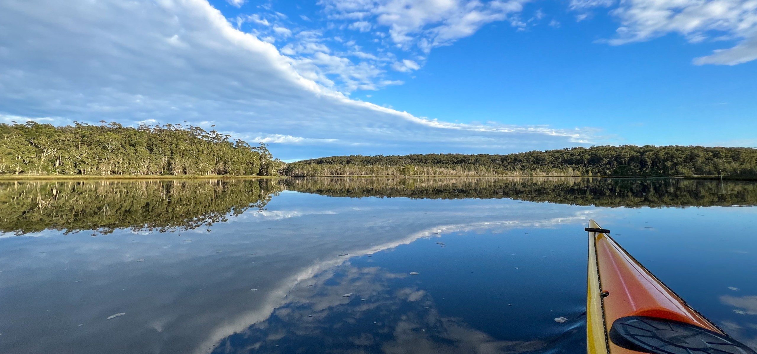
I had planned to spend the week on the Murrumbidgee or Shoalhaven, however the NSW floods have stopped that from happening. So instead I spent 3 days kayaking on random rivers, creeks and lakes on the New South Wales Coast.
Day 1 – 22km – Manning River, Lansdowne River and Ghinni Ghinni Creek
Day 2 – 36km – Hastings River and Limeburners Creek
Day 3 – 11km – Cathie Creek and Lake Innes
Here are the videos of my trip down the Murray River so far.
You can go to my YouTube Channel at https://www.youtube.com/user/auntymonkey01

I am just about to begin my 2.5 month journey along the Murray River from the top of Mt. Kosciuszko to the sea near Goolwa in South Australia.
To follow this adventure, go to https://summittosea.live

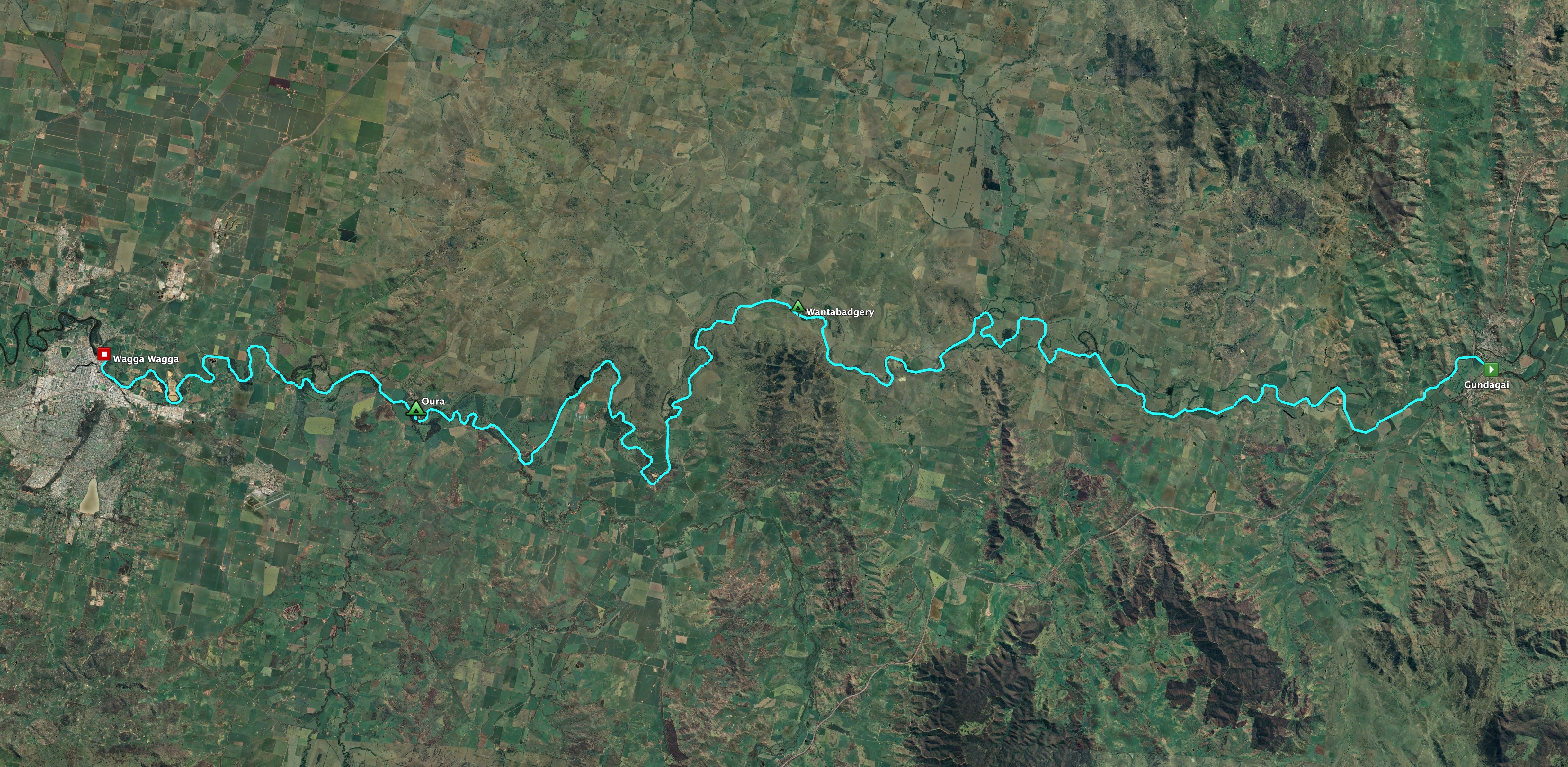
Last week I spent three very enjoyable days paddling down the Murrumbidgee River from Gundagai to Wagga Wagga. I have done a couple of multi-day paddles on the Murrumbidgee this year (Jugiong to Gundagai and Wagga Wagga to Narrandera) and this was the stretch of the river that joined these together.
This was the trip I did for my first multi-day paddle back in 2013. As detailed in an early blog post (Murrumbidgee River – September 2013), I did that trip with a paddling partner, Scott, and we were both new to this type of multi-day paddling. So it was nice to come back to do this trip with a little more experience under my belt.
The Murrumbidgee River Canoe & Kayak Trail Guide recommends this trip should be done in 4-5 days, however I only had a 4 day window to do the trip before I needed to be back in Sydney. This was ok, because from previous trips on this river, I knew that the I was able to paddle a lot further in a day than what was recommended. Plus, the water levels were pretty high (2.8m at Gundagai) which meant that there would be a good current to push me along.
My plan was originally to combine the first 2 days into one by skipping the Limekilns Campsite (which is pretty exposed and basically just a paddock) and then do the rest of the paddle as recommended by the guide. This would include campsites at Wantabadgery, Green Flats Reserve and Oura. In the end, I also skipped the Green Flats Reserve campsite and did the entire trip in 2.5 days.
Day 1 – Gundagai to Wantabadgery
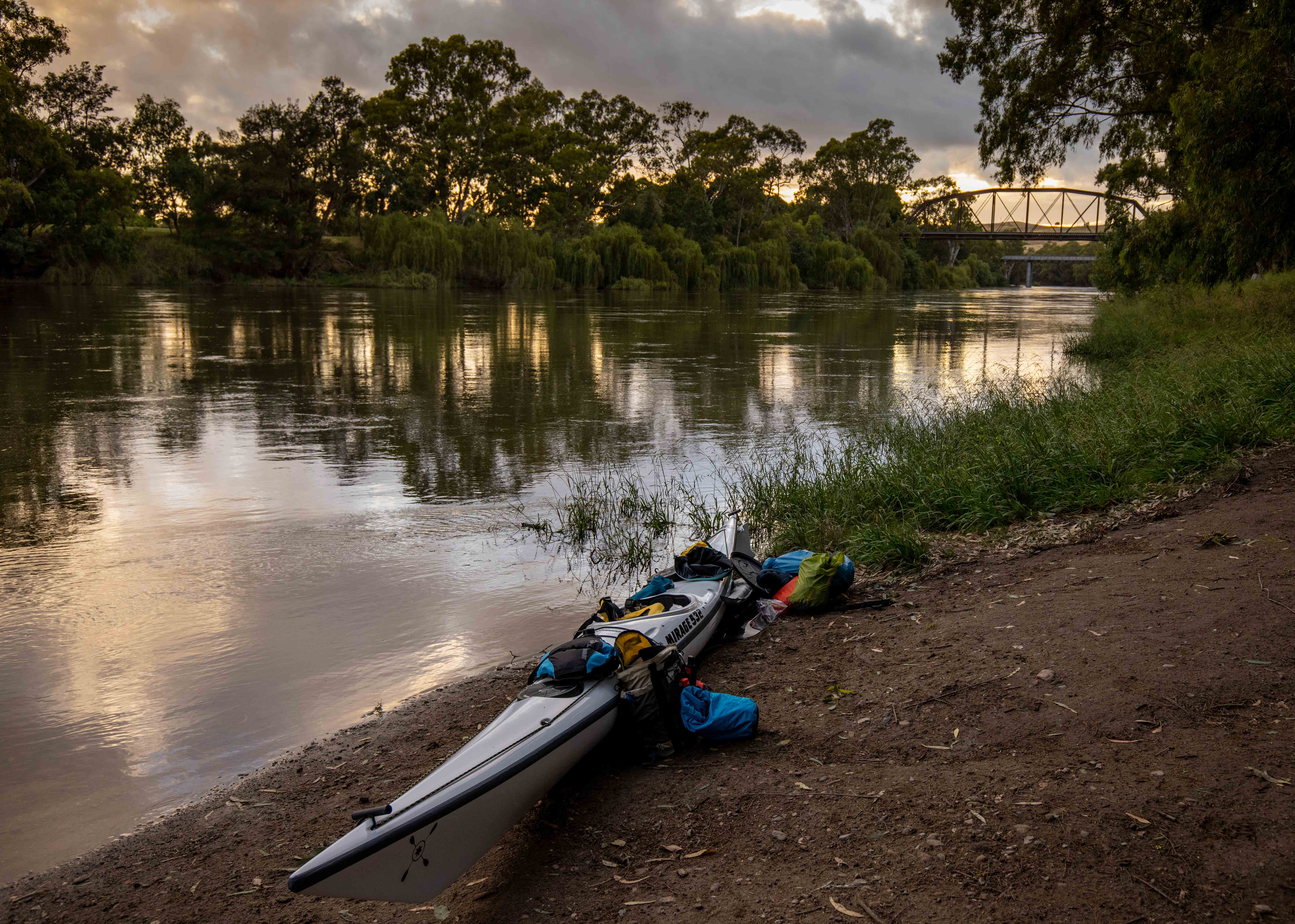
I had planned to spend the night before the trip in the Gundagai Caravan Park, however there was a lot of rain forecasted for that night and I did not really want to start the trip with wet gear, so I spent the night at the Gabriel Motor Inn. This was the right decision because a squally front moved its way through the area which brought a lot of rain and wind. The rain did clear at about 3am, but there was still a forecast for strong Westerly winds to kick in later in the morning. I decided I would get on the water right on sunrise to allow me to make good progress before the wind picked up. It would also be a chance to take some nice sunrise photos and video of the Gundagai bridges.

Since I wanted to get on the water early and I had a fair bit of car/kayak logistics to sort out, I checked out of the hotel around 4.45am and drove down to the river. The main logistic was that I needed to drop my kayak and gear at the river and then drive back into to town to leave my car somewhere safe (outside the police station). The plan was that my parents would pick up my car and drive it down to Wagga for me. As you will read later, this didn’t quite go to plan.
I originally was going to set off on the Gundagai (North) side of the river, under the old railway bridge, however the grass was too long and the bank was too steep. So I had to start on the other side of the river, on the South Gundagai side, which meant my walk back from town was going to be much further. In the end it was a great launching spot, with a nice dirt road (Ferry St) that goes right to the waters edge and plenty of space to sort out all the gear. It ended up being a 30 minute (2km) walk back from where I had left the car. It also ended up being a great photography spot.
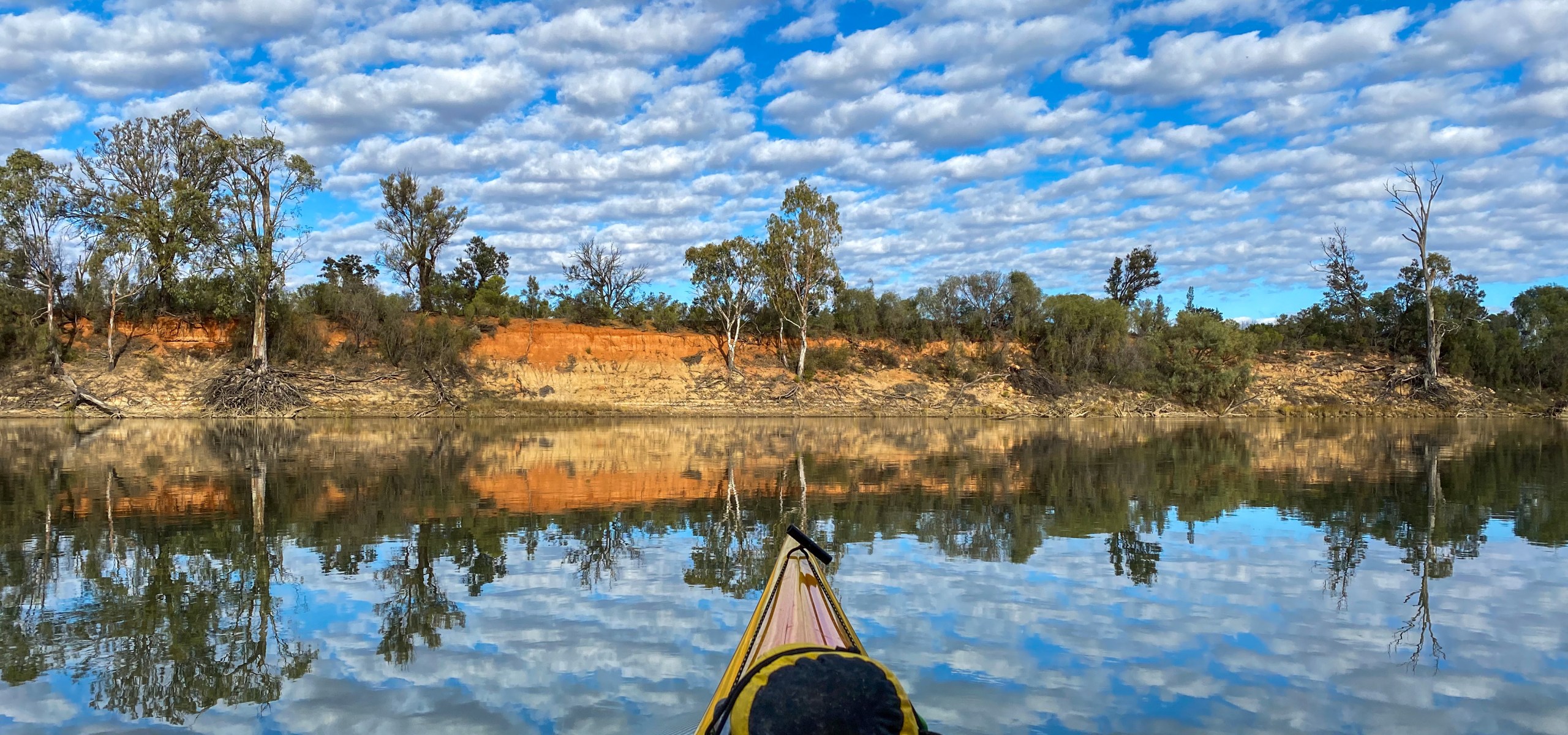
The river was absolutely pumping. A lot of water was being released upstream from Burrunjuck Dam and the level at the Gundagai gauge was 2.8m. To put this into perspective, when I did my trip in March, from Jugiong to Gundagai, it was around the 1.5m mark.
With all the car shuffling complete, photography done and the kayak packed up, I ended up getting onto the water at around 6.45am. Straight away I knew I would be travelling a lot faster than I had planned. I was paddling between 10-12kmh and when I stopped I was still drifting at about 5kmh. The water was pretty swirly, with lots of current changes, little whirlpools and eddies created by the banks, trees and other obstacles in the water. I certainly had to concentrate in most sections to ensure I did not drift into any of the many submerged trees, logs and willow trees.
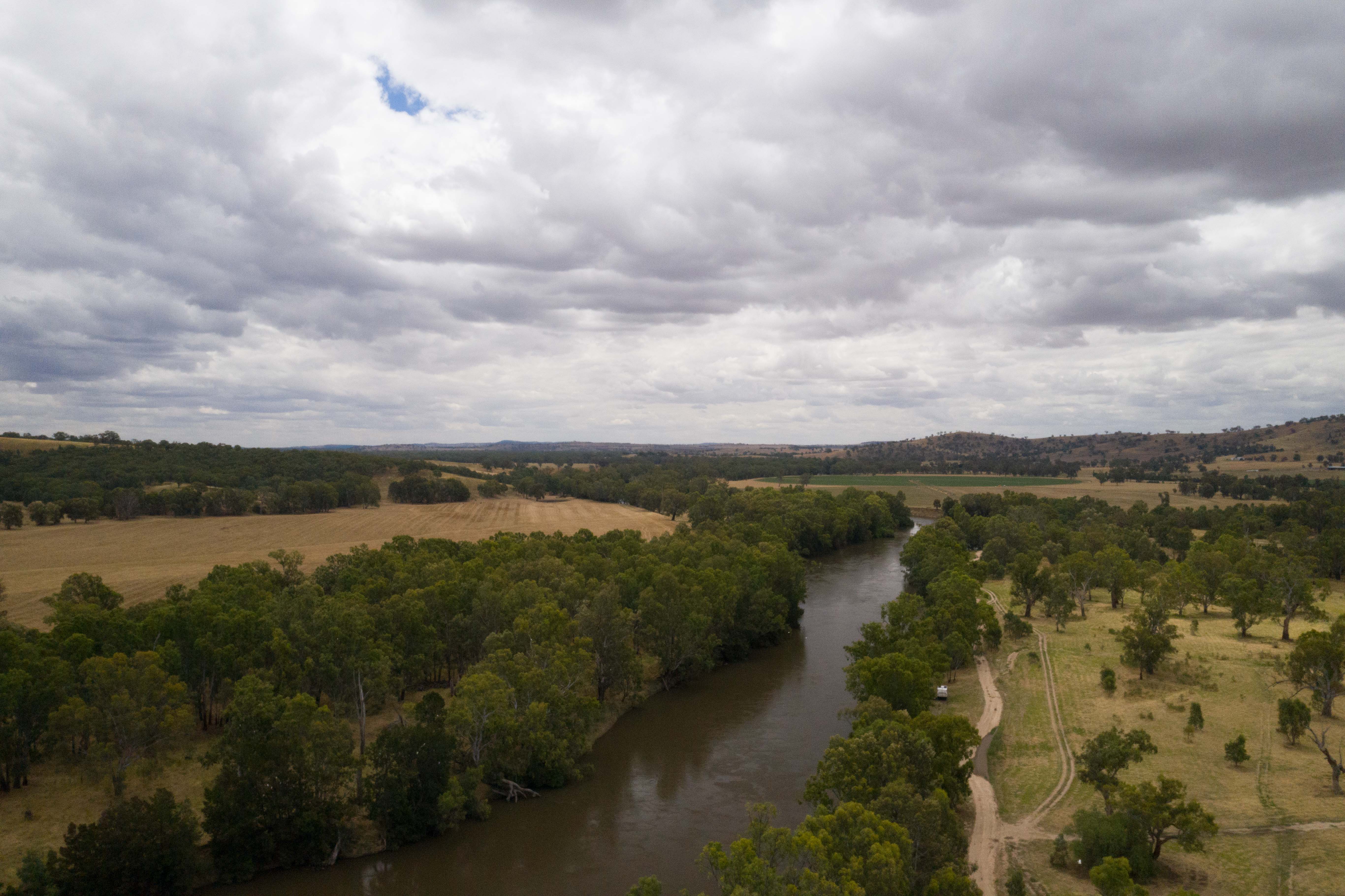
The paddling was pretty uneventful. However it was a lovely chance to soak in all the beauty of the gum trees and listen to the constant squark of the cockatoos.

The wind held off until late morning however, when it kicked in, it was strong and straight in my face. Progress was still fast due to the river flow, but having the wind pushing against me made it feel a lot slower than it really was.
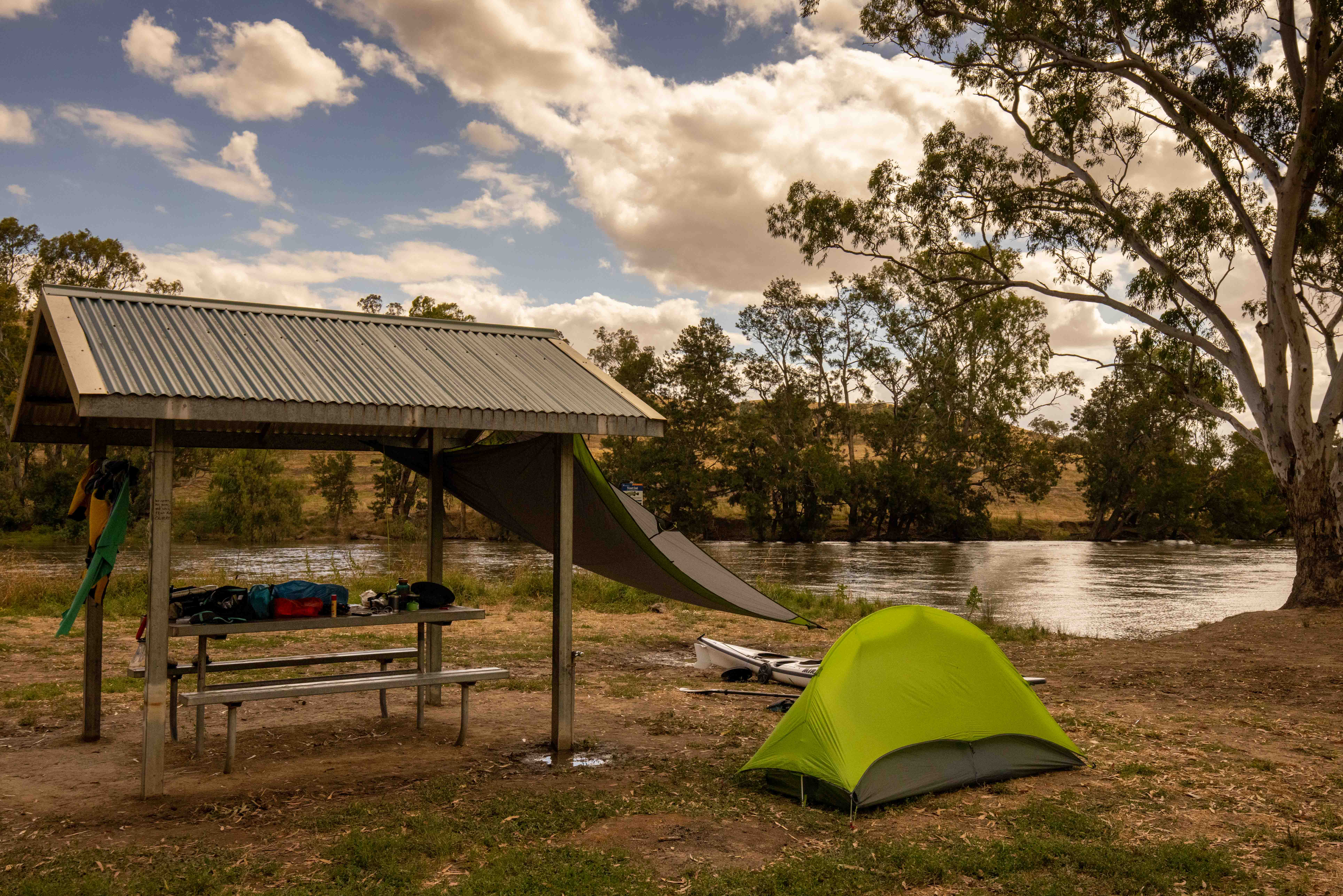
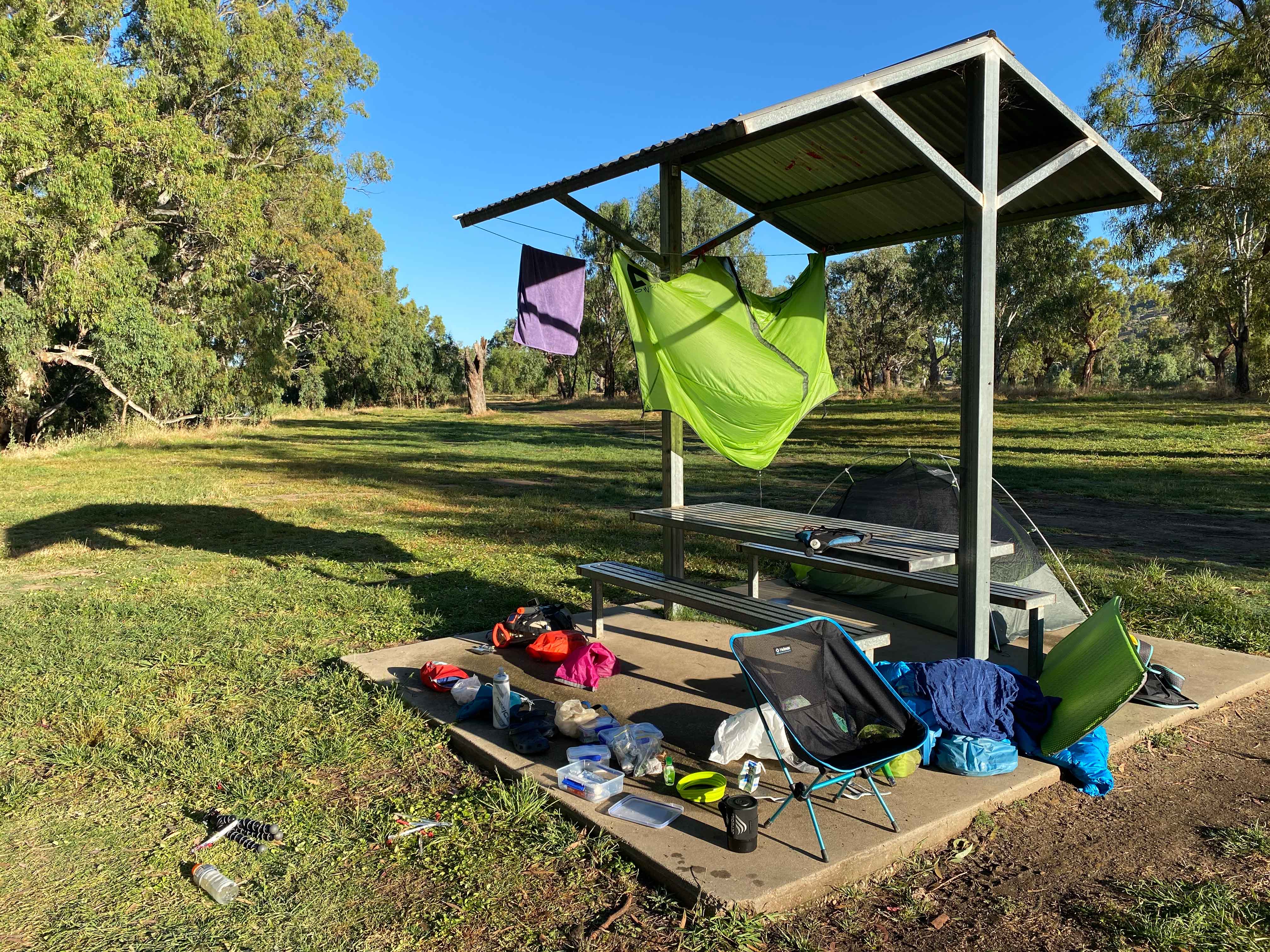
I passed the first campsite in the guide (and where Scott and I spent our first night in 2013), called Limekilns Reserve, at around 10am. I was glad I had planned to push on to Wantabadgery. A few hours later (at around 2pm) I reached the Sandy Beach campsite at Wantabadgery and was delighted to find a nice spot on the edge of the river including a table and shelter. There were a few caravans scattered around the area, however it is a huge campsite (with a couple of relatively clean drop toilets), so I was able to keep to myself.
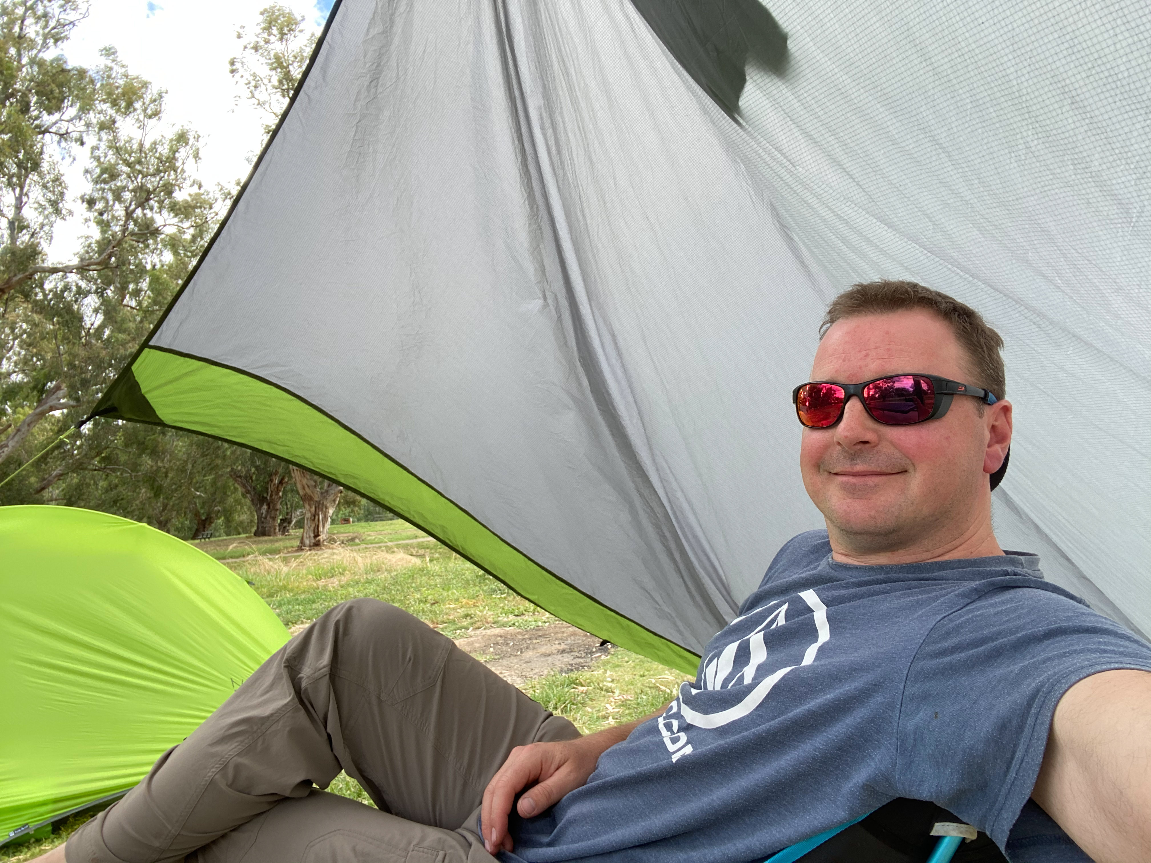
As the sun dropped, the wind picked up even more so I retired to my tent to read my book. I soon realised I had made a bad decision on the tent that I had brought. I normally use my 2 person Macpac Duolite tent however I (stupidly) decided to bring my 1 person Nemo Hornet tent on this trip. I discovered that it is not at all suitable to spend much time in (other than sleeping) because you can’t really sit up fully and moving around was very difficult. I won’t be making that mistake again.

Day 2 – Wantabadgery to Oura
Oh my god… the cockatoos were so noisey in the mornings. Being that it is so late in the year, they were waking up at about 4.30am and proceeded to wake up everyone and everything.
I had originally planned to paddle to the Green Flats Reserve campground on this second day, however, after such a fast water the day before, I realised it was only 15km away and I would be there in a couple of hours. So I decided that I would skip that campsite and push on to Oura. This meant I was in for another longish paddle of 41km.
They had forecasted rain later in the day and predicted more strong westerly winds. Fortunately I was greeted to a nice sunny morning with scattered clouds. It had been cold overnight (9 degrees) but it warmed up pretty quickly and by the time I hit the water (at around 7am) it was a very pleasant temperature.

The paddling was very enjoyable and there seemed to be a lot more bird life on this section of the river. There were also plenty of cows and sheep on the banks to give me strange looks as I paddled past.
I passed Green Flats Reserve at around 9.30am which confirmed that I had made the right decision to keep going. It is a nice open campsite but I didn’t really feel the need to spend all day hanging around there, especially if it was going to rain.
During the morning, clouds started forming overhead and the wind picked up more and more. Fortunately the rain held off and I arrived at the Oura Beach campsite at around 1pm.
The Oura Beach campsite is very large, however all the good spots near the river had been taken by caravans. Unfortunately a lot of the area has large river gum trees, with threatening looking “widow maker” limbs, that I had no desire to camp under in such strong winds. So I ended up having to lug all my gear to the back of the reserve, where I would be clear of trees and where there was another table and shelter. By the time I had set up camp, the wind had really picked up and there was a bit of drizzle around. To provide a bit of protection I was able to use my lightweight tarpaulin to create an awning on the shelter.
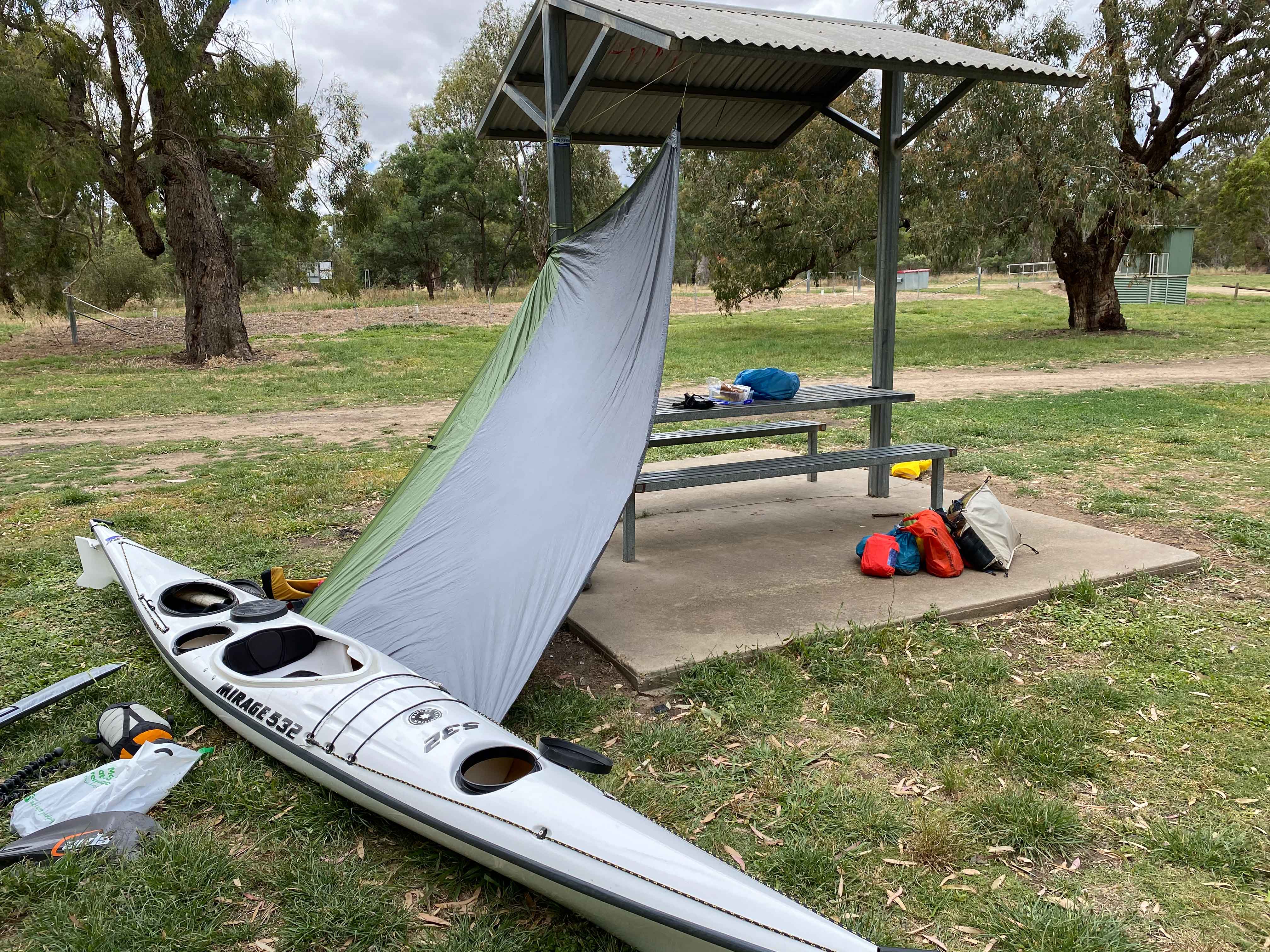
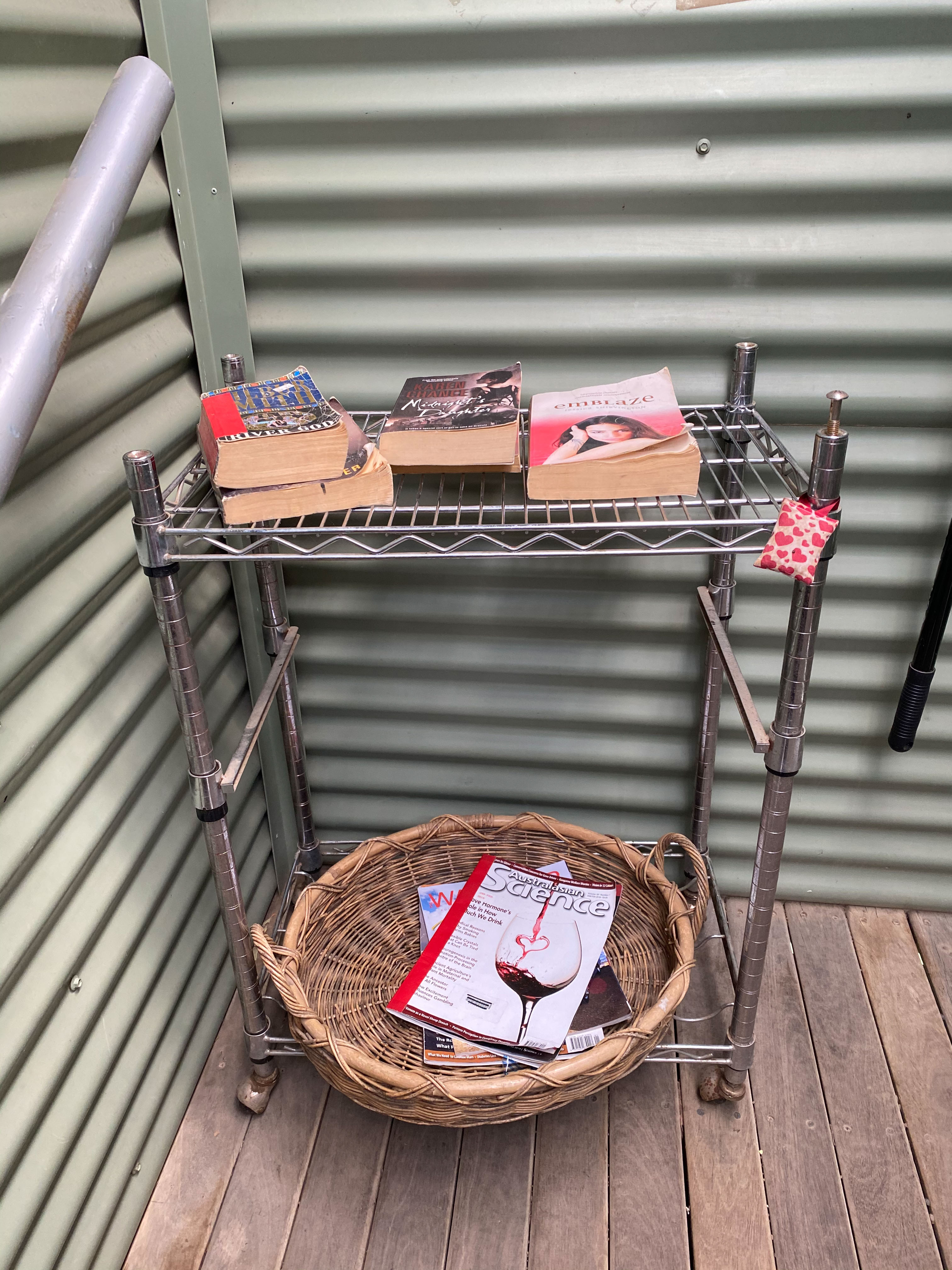
Having spent a lot of time in campsites, I have experienced all levels and types of toilet facilities. I always prepare myself worst when visiting one of these loos. However, I was amazed when I visited to the Oura dunny, which from the outside looked like the normal drop toilet. On entering the tin shed, I found a very clean, flushing toilet. In addition, there was also a rack providing a variety of romance novels and scientific journals to read while enjoying the facilities.
The rain finally kicked in around 8.30pm, so I retired to my coffin like tent and enjoyed listening to the patter patter of the rain on the nylon tent.
Day 3 – Oura to Wagga Wagga
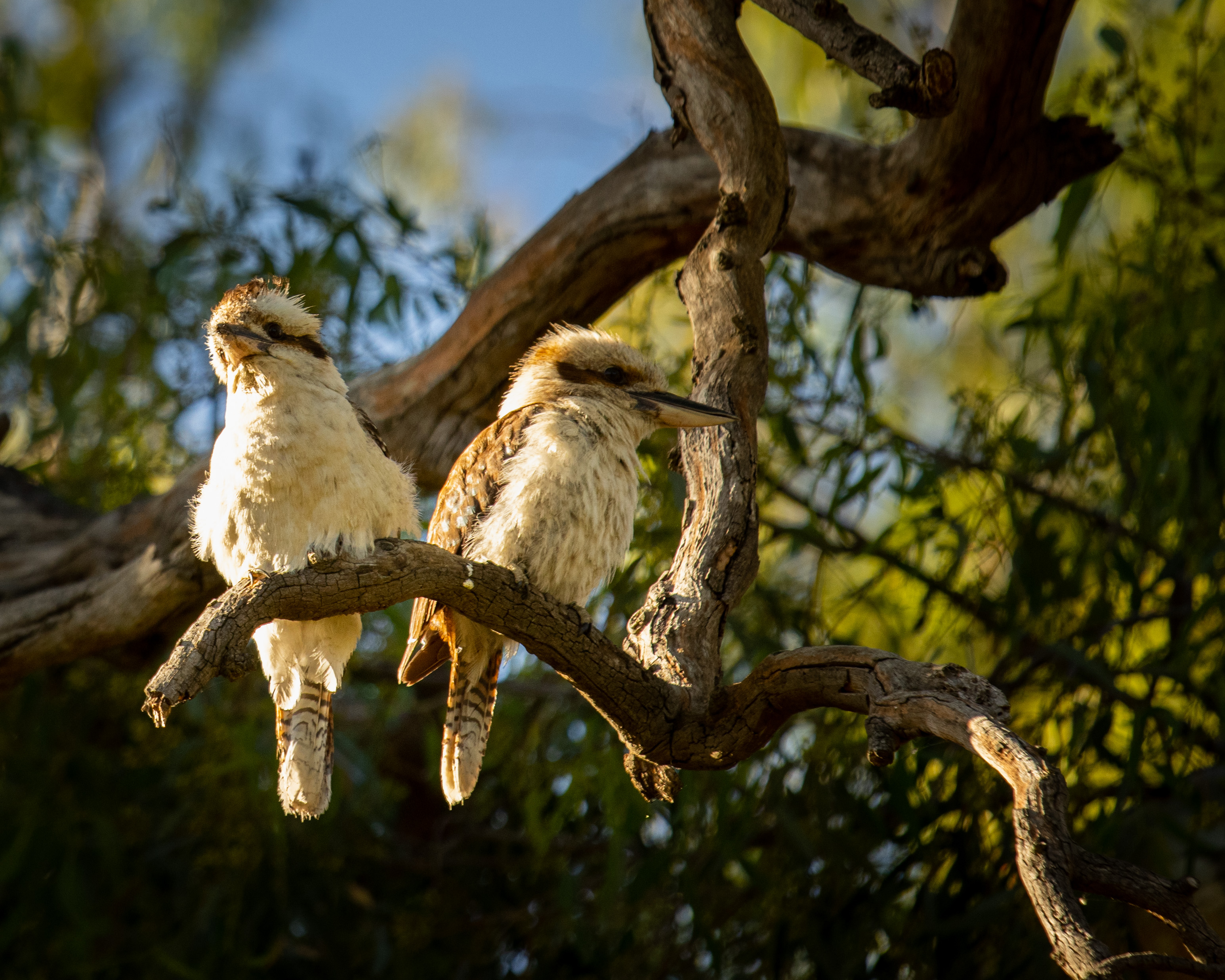
Once again the symphony of cockatoos acted as my alarm clock at 4.30am. This time they were joined by a quartet of kookaburras to add an extra chorus.
Sticking my head out of my tent I saw that the rain had all cleared and the wind had dropped off completely. I only had 26km (about 3hrs) of paddling to do, so I took my time to enjoy a leisurely breakfast and to spread all my gear out to dry in the sun before packing it in my boat.
I hit the water around 8.30am and paddled slowly down the river. I wasn’t in a rush because I had booked a camping site at the BIG4 Wagga Wagga Holiday Park and I wouldn’t be able to check in too early. It was a beautiful morning and I spent a lot of time just drifting with the current.
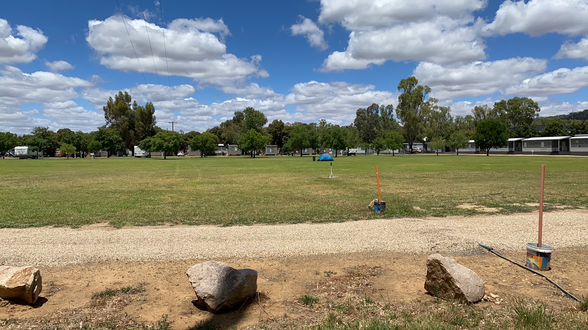
I pulled up on the makeshift boat ramp at the caravan park in Wagga Wagga around noon, just as the GPS ticked over exactly 120km for the entire trip. As I walked (the long way) to the office of the caravan park, I saw that the “unpowered” camping area was a massive, exposed, football oval sized lawn in the middle of the park. There was a solitary tent and suitcase, containing a strange old lady, planted right in the middle. I decided that I had no interest in spending another day/night in my 1 person tent in the middle of an oval, so I upgraded to a cabin. I then had to haul all my gear and kayak (three trips) across the caravan park. This is the last time I don’t take my kayak trolly with me on a multi-day trip.
After a nice shower, I hiked the 3km into the main part of town and enjoyed a nice lunch and a good coffee. This was soon followed by a couple of beers and meal at the Farmers Home Hotel and some time to reflect on my adventure.
Little did I know… the adventure was not over…
Stranded in Wagga Wagga
As mentioned earlier, the plan had been for my parents to pick up my car in Gundagai and drive to Wagga to pick me up. As I arrived in Wagga, my Mum messaged me to say that Dad had the flu and he had to stay in bed. She said that in the morning she would drive the 2.5 hours from their place in Binalong to pick me up. However, as I was leaving the pub, feeling full of food and beer, my wife, Kath, rang me and said “ring your Mum”.
Talking to Mum, I found out Dad had got worse and she had just called an ambulance for him and he was heading to Yass hospital. So I told her not to worry about me and I would get the daily bus from Wagga to Gundagai. When I got back to the cabin I found there wasn’t going to be any seats on the bus for 3 days.
Kath and I discussed options. She suggested I check find out what an Uber or a taxi would cost. Uber didn’t cover Gundagai, so that wasn’t an option. I got a quote from the cab company and it was going to be a whopping $230. My son, James, offered to drive down from Sydney to pick me up, but we realised that a taxi was going to be cheaper than the petrol and another night of accomodation. So a taxi was booked for the morning.
At 7am the next morning I jumped in a taxi, driven by a very friendly driver, and we began the 80km drive down the Sturt Highway to Gundagai. The driver said it was likely to be more than $230, so I spent the entire ride watching the price on the meter slowly ticking over, wondering where it would end. As we pulled up at the police station, where my car was parked, the meter read $260. Definitely one of my more expensive cab rides I have done.
I then headed back to Wagga to pick up my kayak and gear, and headed back to Sydney.
My dad was diagnosed with pneumonia and ended up being transferred from Yass to a hospital in Canberra. Having just got back to Sydney, Kath and I decided that we should head back down to Binalong to give Mum a hand and to help her with the daily 1 hour commute from Binalong to Canberra. I am happy to say that after a few days in Canberra, Dad is now home at Binalong recovering from his “deep” pneumonia.
The Paddle Details
Distance: 120km (exactly)
Duration: 2.5 days
Water Level: 2.8m at Gundagai https://realtimedata.waternsw.com.au/
Average Speeds: Paddle speed ~10kmh, Drift speed ~5kmh
Starting Point: Gundagai – Ferry Street in South Gundagai (-35.07185, 148.10211)
Finishing Point: BIG4 Wagga Wagga Holiday Park (-35.11855, 147.38934)
Day Breakdown
Day 1 – Gundagai to Wantabadgery – 53km in 8hrs
Day 2 – Wantabadgery to Oura – 41km in 6hrs
Day 3 – Oura to Wagga Wagga – 26km in 3hrs

It has nearly been 6 months since I started my career break. It was slightly unfortunate timing that this break pretty much started at the same time as the COVID-19 restrictions. This has not really had a massive impact on what I was planning to do this year, but it looks like it is going to mess with a lot of the overseas travel Kath and I had planned for next year. As a result we have been shuffling around a few of our plans, including bringing forward a big adventure I have been thinking about for a long time. One of the Bucket List items I have been dreaming about for many years has been to kayak the entire length of the Murray River and I am now planning to do this in May and June 2021.
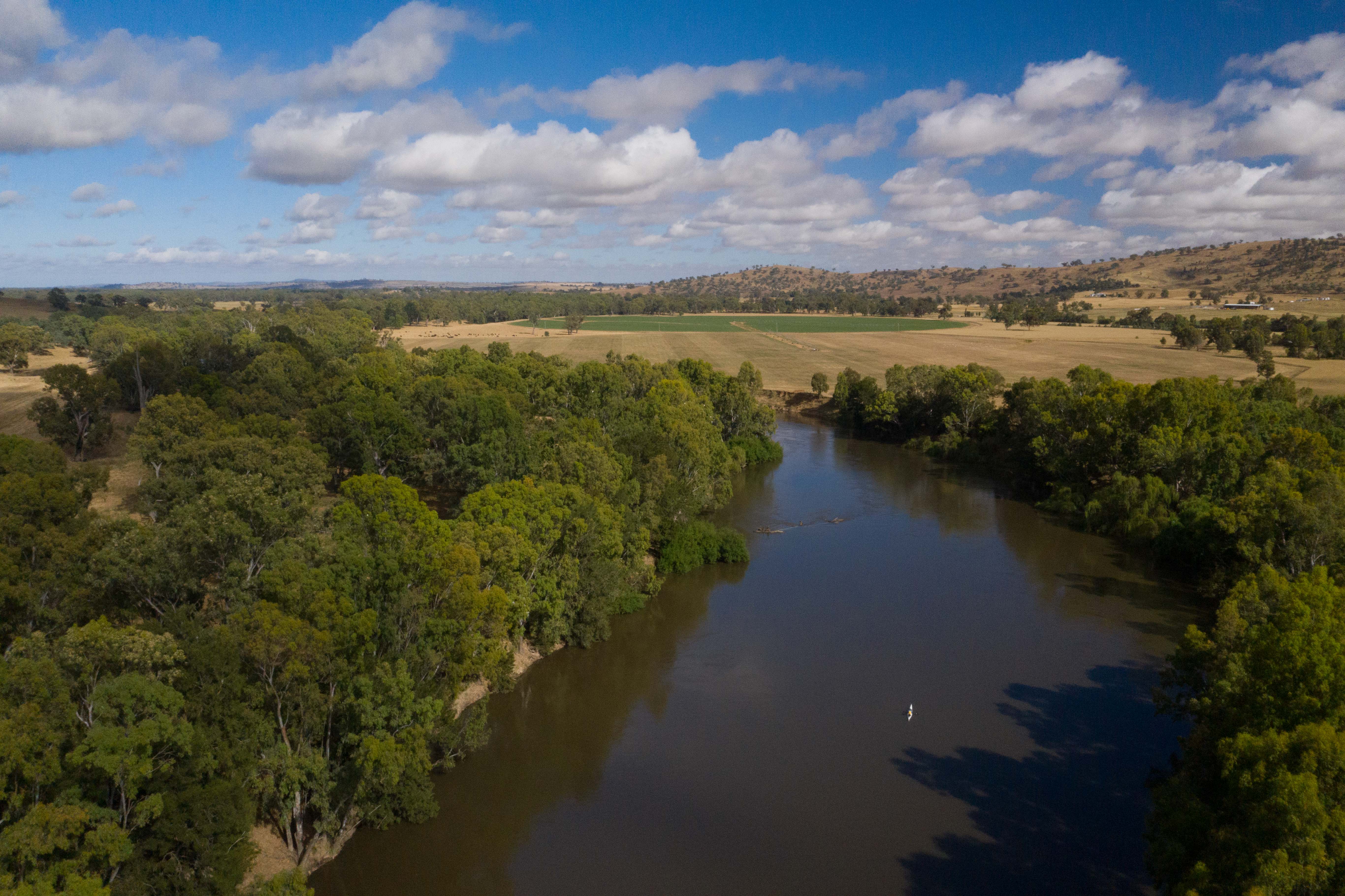
The Murray
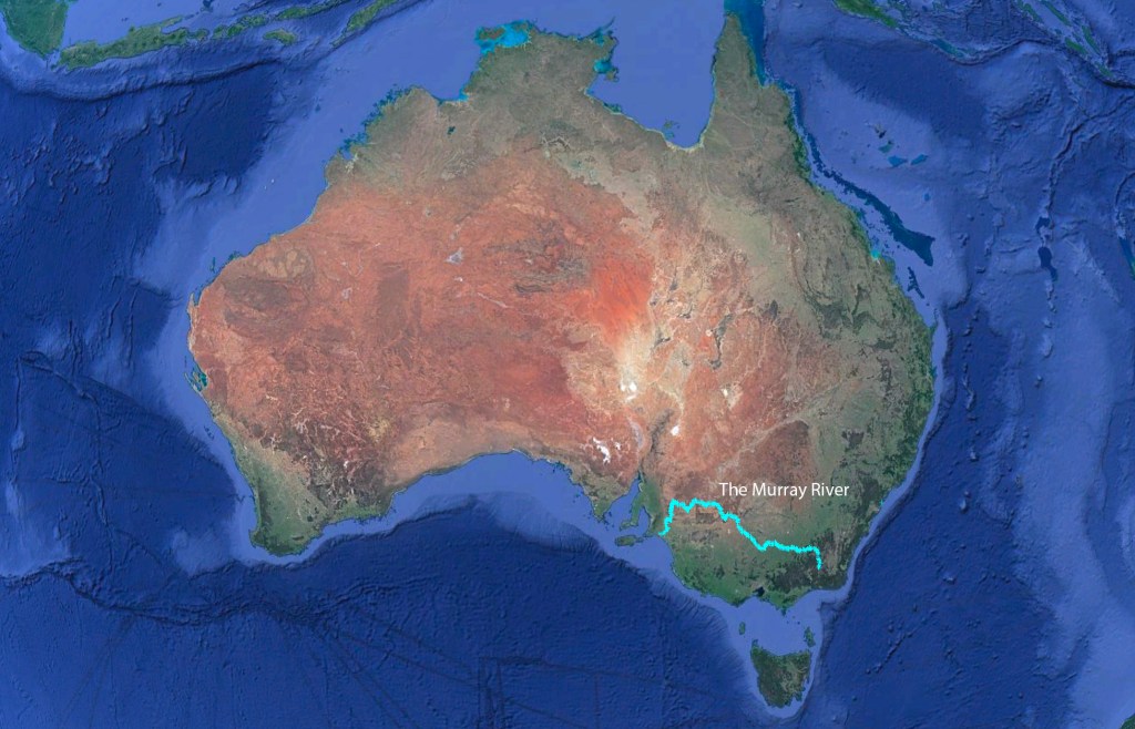
For those not familiar with the Murray River, it is the longest river in Australia (2,508km / 1,558mi) and flows from the Snowy Mountains, near Mt Kosciuszko (Australia’s tallest mountain), along the New South Wales/Victoria border, into South Australia, and then eventually flows into the Great Australian Bight at Goolwa (near Adelaide).
I have always loved The Murray and it seems to have played a role in many ways during my life. As a small kid, when we lived in Adelaide, and our family would have houseboat holidays on the Murray. I have many early memories of catching yabbies and being towed behind the houseboat in a dingy.
In 1996 I spent a year living in Albury while studying at Charles Sturt University. During this (very fun and crazy) year we spent a lot of time swimming, kayaking, partying and just hanging out on the Murray.

The Murray River also played a role during my formative years of ballooning and competition ballooning. Every year, during the mid 1990s and the early 2000s, we would spend weeks in Mildura, flying and competing over (and sometimes in) the river.
Being that The Murray acts as most of the border of Victoria and New South Wales, which are the two states that I have spent most of my life travelling around, I have crossed the river countless times. The Murray River has always seemed to be there and now I plan to see all of it.
Unfortunately, the Murray River is not a very healthy river. Over the last century there have been serious environmental impacts to the waterway and the surrounding areas. The introduction of dams and irrigation have altered the river’s natural flow significantly and increased salt levels. Runoff from agriculture and the introduction of foriegn species, such as the European carp have had a big impact on the native species. There has been a lot of contention and conflict at a Federal and State level about the use and protection of the river. One of the big reasons I want to paddle along the river is so I can see all of these issues first hand and get a better understanding of the issues. I also fear that it is only going to get worse and I want to experience it before it does.
Bringing the Trip Forward
I had planned to do this trip in September 2021, when the water levels below the Hume Weir would be at their highest, however I have decided to bring this trip forward to May 2021. There are a number of reasons for bringing it forward by 5 months. The first is that it will help fill in the time while international travel is still restricted (we are assuming restrictions will continue in the first half of 2021).
The second reason is that the weather will be better for the section in the Snowy Mountains. If I was to start in September, I would be dealing with early spring cold (and snowy) conditions in the High Country and then late autumn / early summer (hot) weather in South Australia. As you read further in this post about the plan, you will see why the weather in the High Country will be a consideration.
The final reason is probably the most important… I just want to get on with it. So early May is the planned start.
“Summit to Sea” not “Source to Sea”
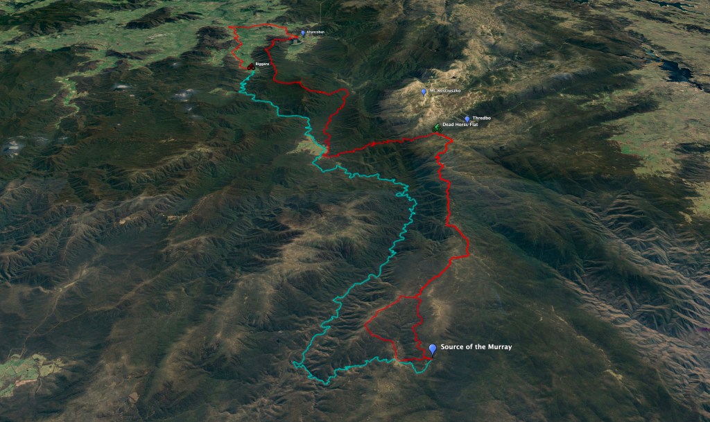
The actual plan for this adventure has changed a few times, but I have finally worked out what it is going to be. Originally I wanted to paddle the Murray from “Source to Sea”. However I have discovered that the term “Source to Sea” is fairly contentious in the kayaking world, because technically it is impossible to paddle from the source as it is a tiny trickle of water (if it has been raining) on the side of Mt. Kosciuszko. Basically the first 110km of the river is not really able to be paddled and it is in some of the most remotest parts of the High Country. As a result, many people who paddle “the entire” Murray River often start as far down as the Hume Weir which is some 330km downstream from the Source.
I had originally planned to just start the journey at a place called Biggara (near Khancoban), so I would be paddling the entire “navigable” length of the Murray River. However, the more I thought about this it started bugging me. It felt like I was missing out on the first 110km of the river and I wasn’t really going to be travelling or seeing the entire length.
A few people have hiked along the first stretch, but it just looks miserable and very difficult. It would also be something I would not want to do solo. Afterall, my trip is not about conquering the river, it is about enjoying it and experiencing it.
I then came up with a better idea that I am happier with. I was scrutinising the map of the Upper Murray and found there were various remote tracks and fire trails near the river. I was able to plot a route through the mountains that kept me pretty much in the same valley as the river and within a few kilometers the river for most of the time. I also realised that the starting point was so close to the top of Mt. Kosciuszko, that the idea then morphed into travelling from the top of Australia (the summit of Mt. Kosciuszko) to the Sea (Goolwa) via the true Source of Murray River.
So that is the plan, I am going to travel from the Summit to Sea.
The Details
So how is it going to work? Well I am not going to describe the entire trip now, but here are the main points.
The entire journey will be approximately 2,600km. I will consist of a small amount of walking, a bit of biking and then a whole lot of paddling. To put that distance into perspective, that is the same that Melbourne isn to Cairns, London is to Moscow and Los Angeles is to Chicago.

The Hike
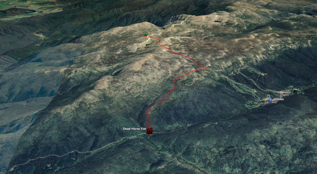
The first section will be a short hike (11km) from the summit of Mt. Kosciuszko to Dead Horse Gap where I will transition to my bike.
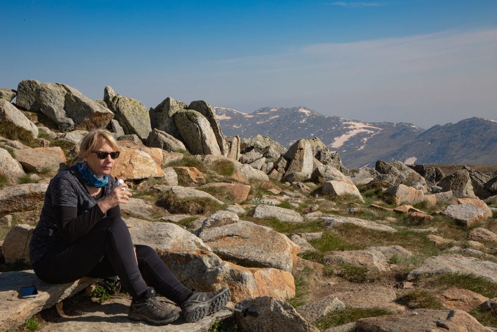
For those people overseas, when we talk about Australia’s tallest mountain, it really is just a big hill. The peak is only 2,228m high but it does get covered in snow in the Winter months (usually between July and September). It is definitely not the type of mountain that other continents such as Europe and Asia have, as there is a paved track to the top and a toilet block just below the summit. Kath and I hiked there last year just before Christmas and it is a beautiful part of the World.
The Ride
After I have hiked (strolled) down from the Summit, I will meet Kath at Dead Horse Gap and pick up my bike and camping gear. I will then ride down Cascade and Cowombat Trails to Tin Mine Hut (about 40km). From there I will be able to hike the few kilometers to the true source of the Murray (based on GPS coordinates). Apparently there is a small marker in the middle of the bush.
I will then have to ride back uphill to Dead Horse Gap and then head down the Alpine Way back to the river at Tom Groggin campground. From there I will have to ride back up about 1,000m of elevation to top of Mt. Youngal (1,514m) and then I ride down a remote track called the Indi Track to Khancoban and then to Biggara.
All up, the ride will be about 200km and should take me about 4 days.
Being that I have not done much mountain biking (or any biking) in the last 10 years, the bike ride is the bit that will require the most training. Right now the 2,000km of paddling sounds easy compared to the 10km (and 1,000m gain) ride up Mt. Youngal.

The Paddle
This is obviously the bulk of the trip. At Biggara, I will transfer all my camping gear from my bike to my kayak. I then start paddling all the way down to South Australia. There is so much information I could write about the paddle, but I have no idea where to start. Basically it should take about 8 weeks to cover the 2,400km.

I will be living out of my kayak and camping on the side of the river most nights. There will be towns along the river every few days, so I will be able to restock my food, recharge batteries and post photos and videos. The longest section of the river without towns is between Wentworth (near Mildura) and Renmark, which is about 270km and should take about 5 days.
I don’t want to rush the trip. I want to experience it properly and spend time meeting people and experiencing the different environments. I plan to have a rest day roughly each week to give the body a rest, to break the monotony of paddling, to edit videos and to wash my clothes. Being that I am going to be paddling into Winter, I also foresee there will be the occasional day that the weather is too nasty to be on the water.
Support and Logistics
I plan to do the majority of this trip solo and unsupported, in that I will be living out of my kayak (and bike).
As mentioned earlier, there will be a bit of logistics switching from hiking, to biking and to kayaking. The current plan is that Kath (and maybe other family members) will spend a week up in the Snowy Mountains doing some day walks and relaxing. Kath will then be able to meet me at the appropriate switch over points to give me my bike and then to swap my bike for my kayak.
Being that I will be away for a couple of months, Kath (and maybe James) will also meet up with me a couple of times along the way. The current thinking is that she will drive down to Echuca for a few days, which is about a ⅓ of the way along the river. A few weeks later she will drive down to Mildura (about ⅔ of the way) and spend some days there. She will then leave the car in Mildura and fly back to Sydney. That way, she can then fly back to Mildura a few more weeks later, pick up the car and drive down Goolwa and meet me at the finish. And people think balloon retrieving is complicated.
Between Now and Then
There is actually not a huge amount of organisation from a logistics perspective required before May. I just need the State governments to open up the borders between New South Wales, Victoria and South Australia. They keep saying they will be open by Christmas, so I am assuming we should be fine by May. And hopefully we will have a COVID-19 vaccine by then.
From a kayaking perspective, there is also not a huge amount I need to do. I have done enough multi-day paddle trips recently to have tested and sorted out all my kayaking and camping gear. I also paddle a few times a week, so I am (currently) paddle fit and as long as I keep that up I will be fine.
Even though the bike ride will only be 4-5 days, it is the bit that needs the most preparation. I haven’t ridden properly for years and I even sold my mountain bike a couple of years ago. So the other day I bought a new bike (Kona Unit X) that will be more appropriate for multi-day off road rides. I went for my first ride on it yesterday and my butt and legs are now telling me that I have a fair bit of work to do to get ready to take on the Snowy Mountains.
In the meantime I will continue to post more blog posts and will resurrect my Vlog between now and May with more details so everyone can follow the progress.
Time to go and ride up some hills.
